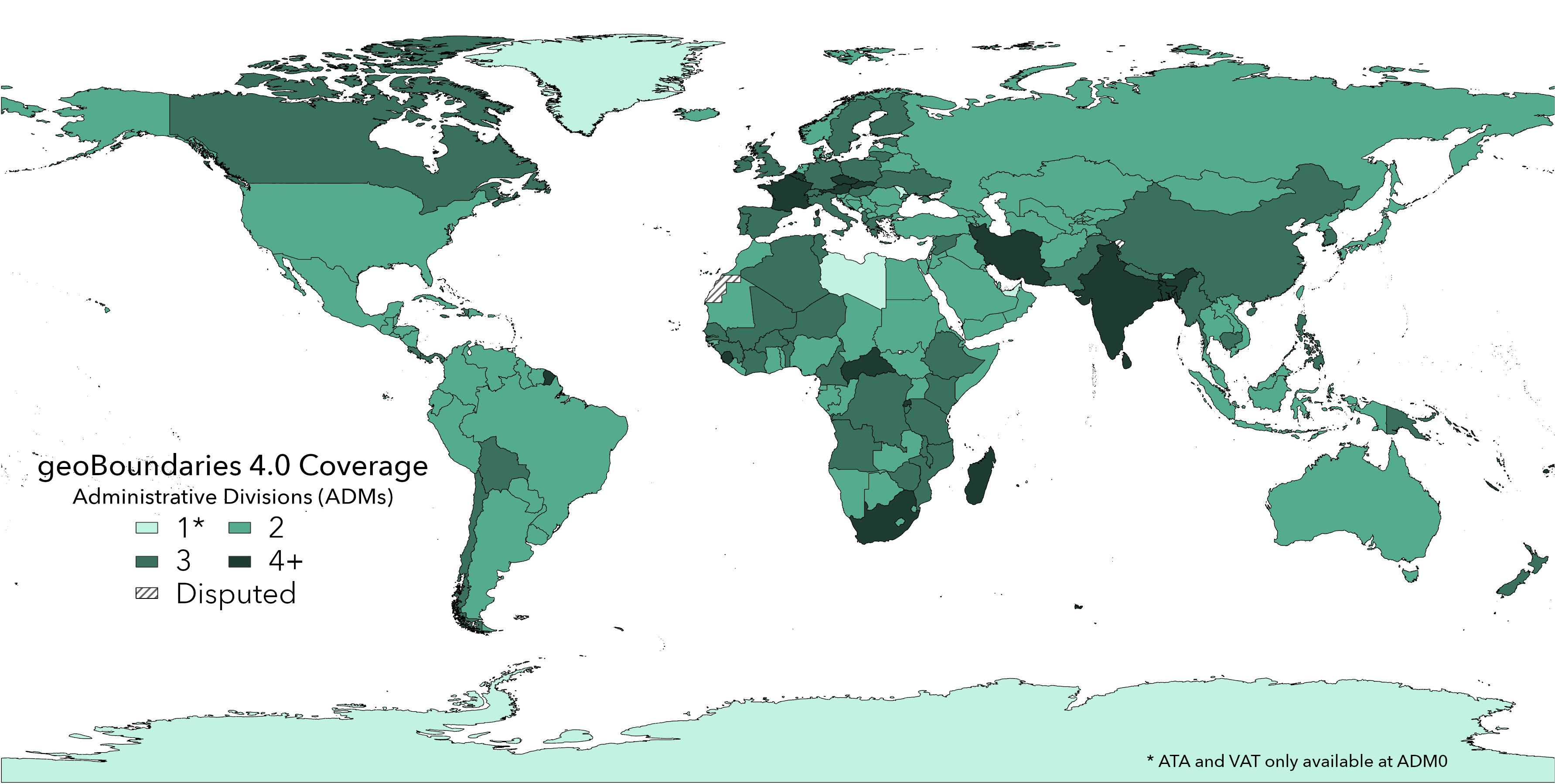
Produced and maintained by the William & Mary geoLab since 2017, the geoBoundaries Global Database of Political Administrative Boundaries Database is an online, open license resource of boundaries (i.e., state, county) for every country in the world. We currently track approximately one million boundaries across over 200 entities, including all 195 UN member states. All boundaries are available to view or download in common file formats, including shapefiles; the only requirement for use is acknowledgement.
The work described on this page was generously supported by the following organization(s):
McGovern FoundationJeffress Trust Awards Program in Interdisciplinary Research
Bill and Melinda Gates Foundation