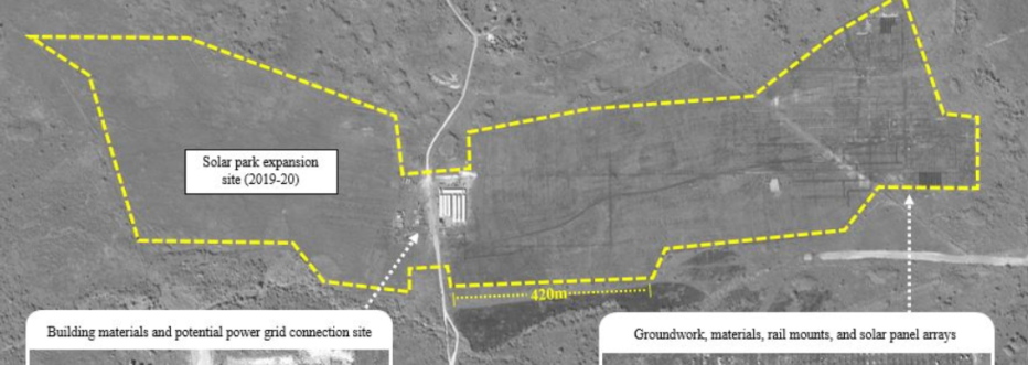
The geoInt project focuses on better understanding the evolution of international actors programs using high resolution satellite imagery. Through qualitative analysis of time series pictures, students and staff working with the geoInt community will carefully annotate imagery to explore how on-the-ground conditions may have changed as a product of planned activities by groups from China, Russia, and related powers. From ports to sustainable power projects, findings help to inform us as to the reality of projects on-the-ground: their environmental footprints, and the success or failure of projects. This satellite information is used in conjunction with other sources (i.e., open source news media) to help tell previously untold stories about the ways in which global actors are impacting local conditions in geopolitically important regions.
geoInt
Description
Using satellite imagery to understand geopolitical shifts caused by international actors.
Timeline:
Spring 2019 to Present
People:
Dan Runfola, Robert Marty, Matthew Crittenden, Celia Metzger, Kate Munkacsy, Monica Sandu, Emily Maison, Monica Alicea, William Weston, Caroline Morin, Erin Horrigan, Remington Fritz, Maya Deutchman, Garrison Goetsch, Cole Spiller, Katerina Viyella, Amelia Grossman, Rachel Li, Yiwen Sun(Wendy), Landon Clime, Asha Silva, Kaitlyn Wilson, Tara McLaughlin
You may also enjoy
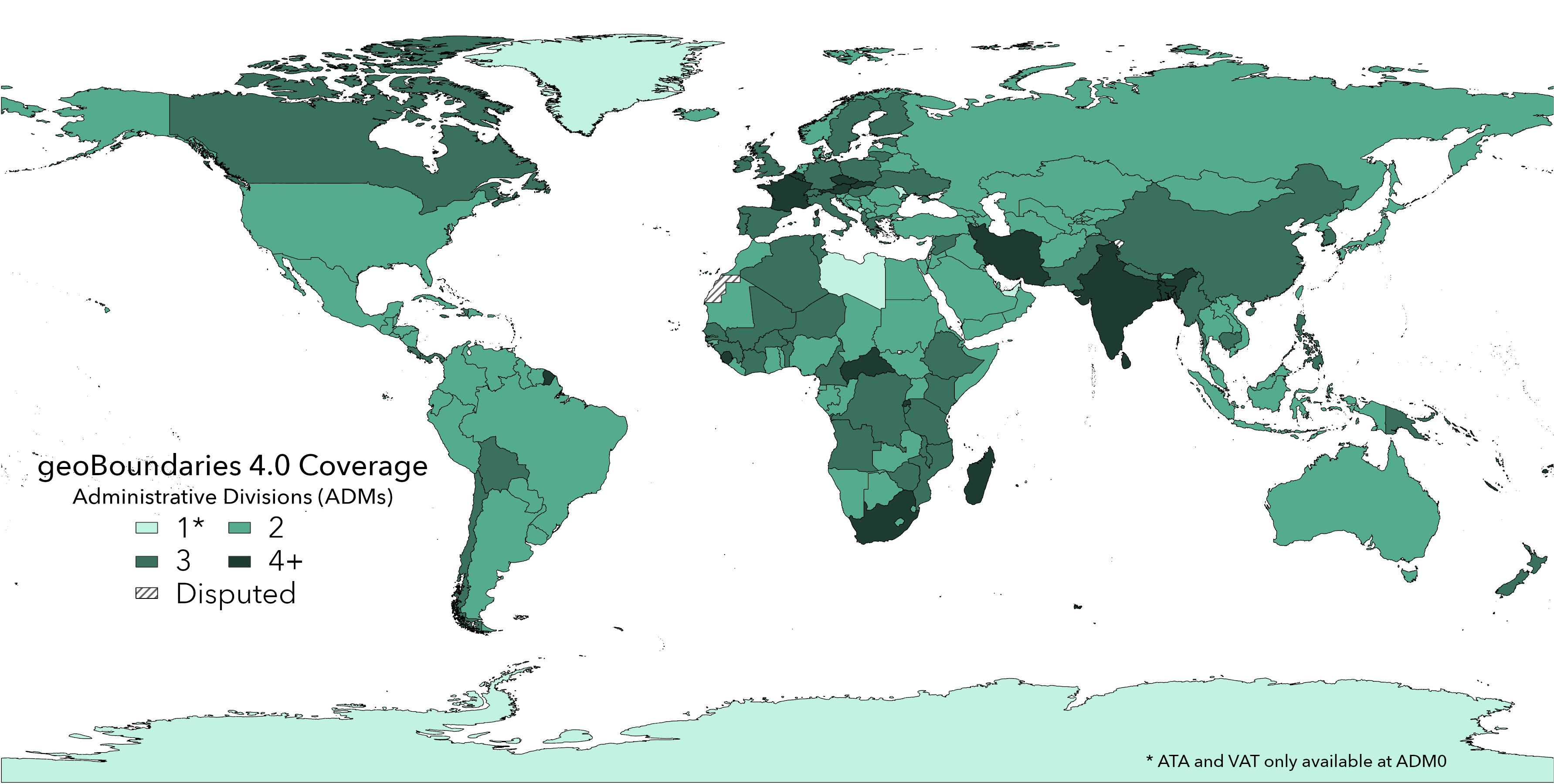
geoBoundaries 4.0 Release
The fourth iteration of our original dataset.
Using Satellite Data and Deep Learning to Estimate Educational Outcomes in Data Sparse Environments. Permalink
In this article, we present a case study estimating school test scores based solely on publicly available imagery in both the Philippines (2010, 2014) and Br...
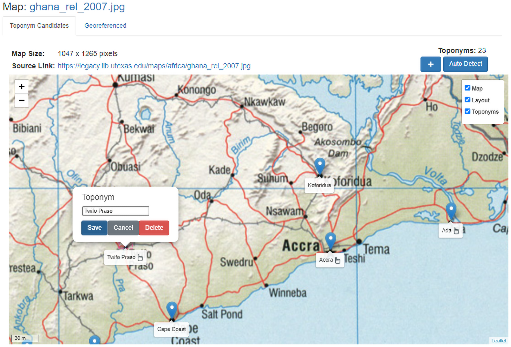
Toponym-assisted map georeferencing: Evaluating the use of toponyms for the digitization of map collections Permalink
This paper introduces a fully automated method based on map toponym (place name) labels. It is the first study to demonstrate these methods across a wide ran...

geoLab: 2021 Annual Report Permalink
Our annual report for the year 2021.